ex03_svi_eqtomo
This example applies GMT Earth relief to the flat SVI EQTOMO model with
-Oa while processing Vp, Vs, and Density together. The diagnostic
surface is inferred across all three parameters. If their shallowest valid
levels disagree, topobath reports the disagreement, uses the shallowest
shared boundary, and retains any field-specific NaN at that boundary.
The script uses the cached one-arc-minute Cascadia crop of GMT’s
@earth_relief_01m_g dataset. If the crop is unavailable, it is downloaded
once and reduced to longitude/latitude = -130/-116/39/52 before any 3-D
operation begins.
SVI EQTOMO uses kilometers for depth, kilometers per second for velocity,
and grams per cubic centimeter for density. The relief modifier
+z-0.001+Zkm converts positive-up meters to the model’s positive-down
kilometer convention. All transformed models span -T-5/2/0.1.
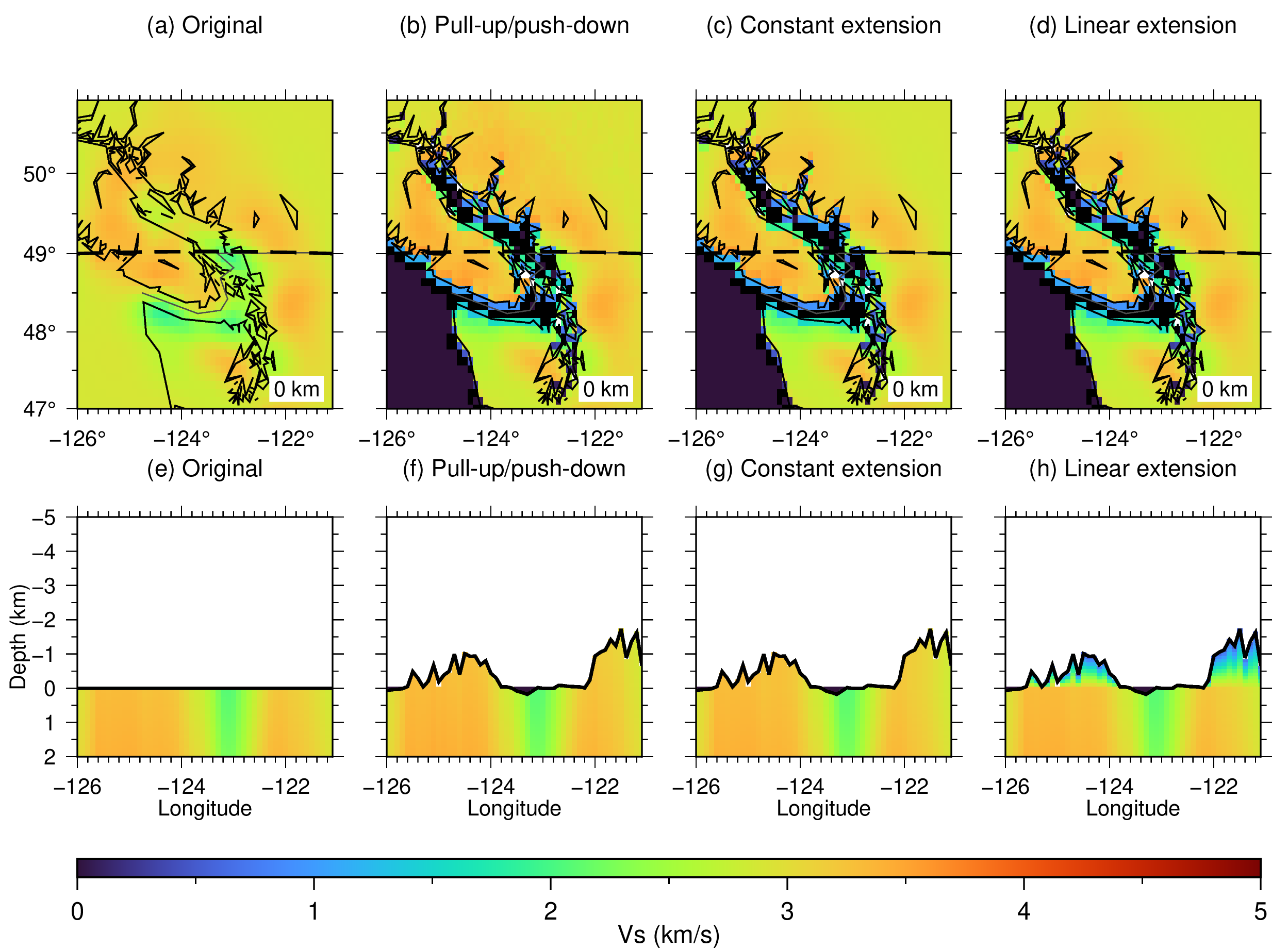
The methods figure compares the original model with -Oa -Mp,
-Oa -Me, and -Oa -Ml using Vs. Maps show zero depth, and sections
follow latitude = 49 N.
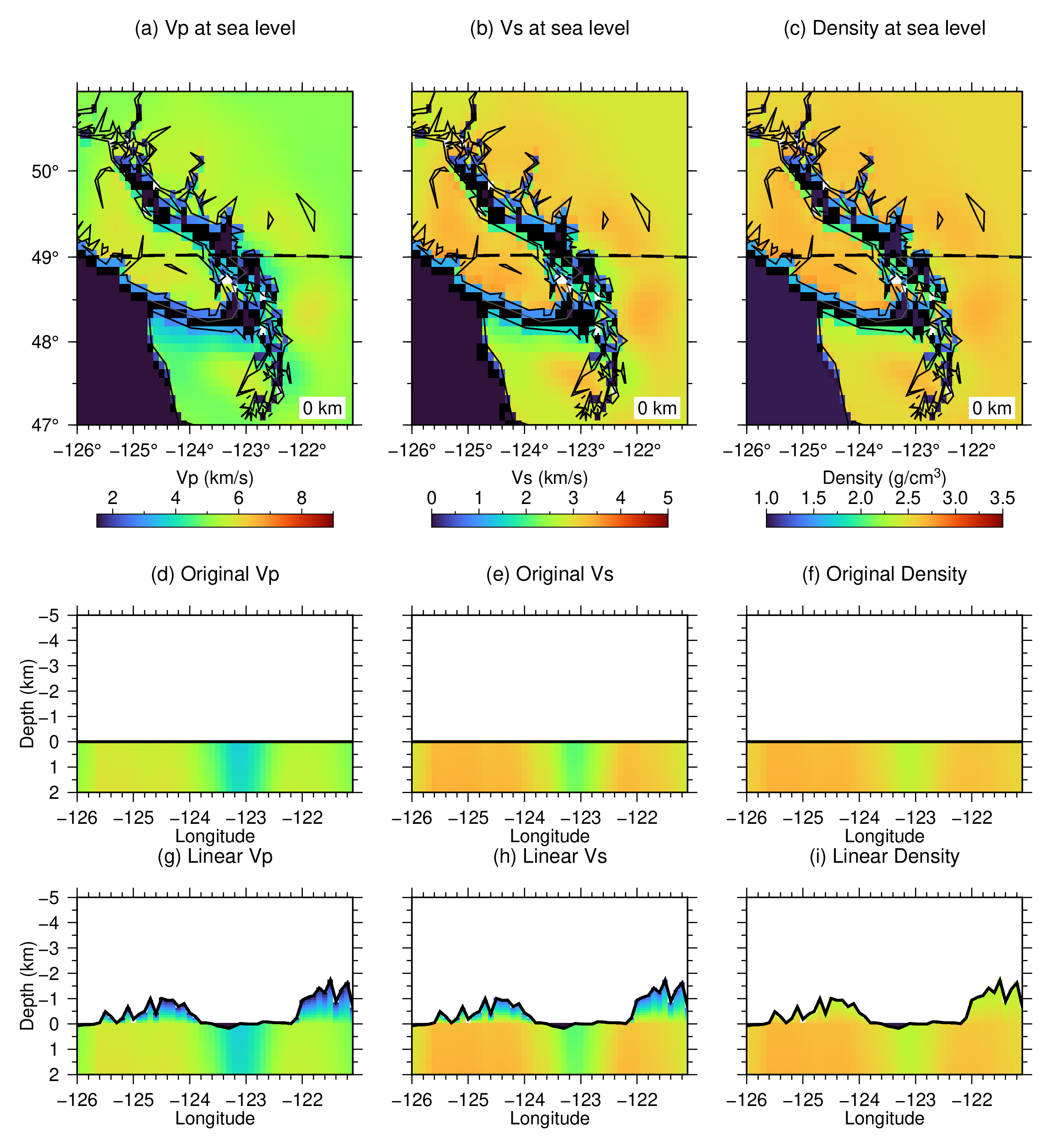
The parameters figure shows the linear result for all three fields. Linear surface minima are supplied separately:
-LVp/1.5 -LVs/0.5 -LDensity/2.3
Water values are also defined independently as 1.5 km/s, 0 km/s, and
1.03 g/cm3 for Vp, Vs, and Density, respectively. Because the original
model is solid up to zero depth, wet regions use that common shallowest
boundary before the new bathymetry and water values are applied.
Run:
./ex03_svi_eqtomo.sh
Intermediate NetCDF models are removed when the script exits. The script creates:
ex03_svi_eqtomo_methods.pngandex03_svi_eqtomo_methods.pdfex03_svi_eqtomo_parameters.pngandex03_svi_eqtomo_parameters.pdf
Figures