ex02_pnw10_s
This example applies GMT Earth relief to the flat PNW10-S shear-wave
velocity model using the three topobath construction methods. Unlike the
ANT+RF model in the previous example, PNW10-S begins at zero elevation and
does not need to be flattened first.
The shared Earth relief grid is a one-arc-minute crop of GMT’s
@earth_relief_01m_g dataset over longitude/latitude =
-130/-116/39/52. The script creates and caches this 1 MB regional grid if
it is unavailable. Every topobath operation then uses the local file.
PNW10-S stores depth in kilometers, positive downward. The relief grid stores
elevation in meters, positive upward, so +z-0.001+Zkm converts the relief to
the model convention before sampling. The transformed models use
-T-5/2/0.1, from 5 km elevation to 2 km depth at 0.1 km spacing.
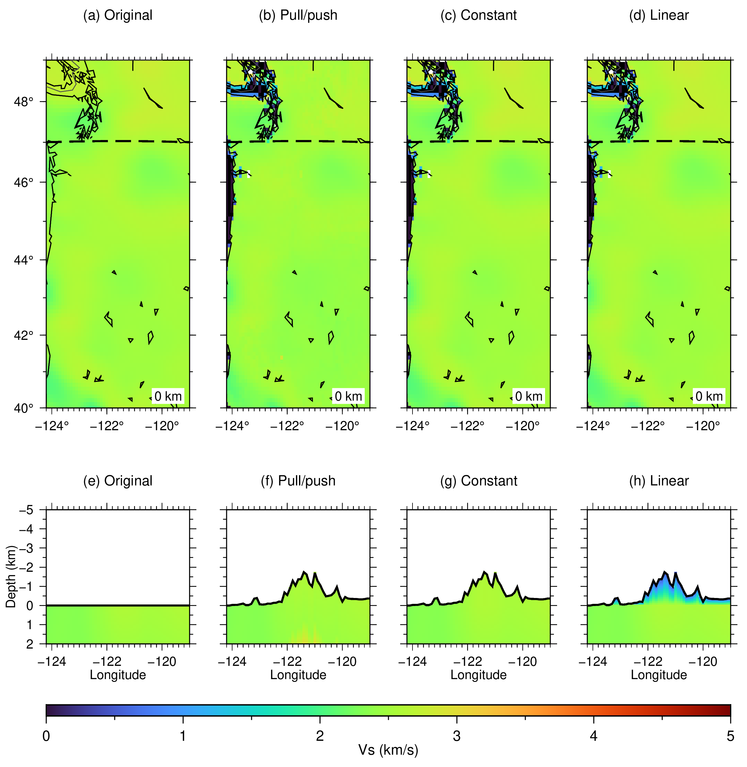
The methods figure compares:
the original flat model resampled onto the requested output lattice
-Oa -Mp: pull-up/push-down addition-Oa -Me: constant one-dimensional addition-Oa -Ml -LVs/0.5: linear addition to 0.5 km/s at the land surface
The top row shows Vs at zero depth. The bottom row shows latitude = 47 N
sections through the uppermost model. Dashed lines on the maps mark the
section location. The original section has a flat surface at zero, while the
other sections show the applied relief with solid lines. In wet regions, the
flat model’s common shallowest boundary is retained and -WVs/0 defines the
new water column above the seafloor.
Run:
./ex02_pnw10_s.sh
Intermediate NetCDF models are removed when the script exits. The script creates:
ex02_pnw10_s.pngex02_pnw10_s.pdf
Figures